
File:POLSKA mapa woj z powiatami.png
Saizi ya chakuona ichi: 646 × 600 pixels. Mu misani inyake: 259 × 240 pixels | 517 × 480 pixels | 1,021 × 948 pixels.
Chinthu cha kwenekuko (1,021 × 948 pixels, file size: 467 KB, MIME type: image/png)
Mbili ya chinthu
Dofyani pa siku/nyengo kuti muone umo vikaonekela pa nyengo iyo.
| Siku/Nyengo | Kachithuzi | Vipimo | Mgwiliski | Ganizo | |
|---|---|---|---|---|---|
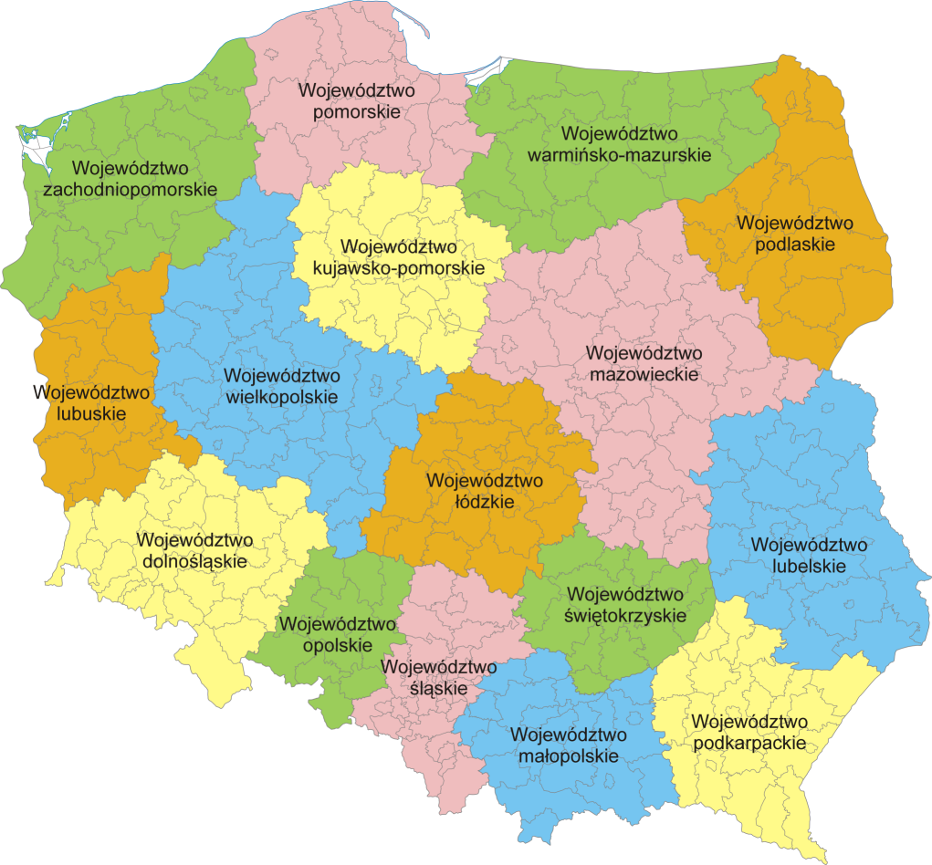
| sono | 20:37, 5 Febuluwale 2007 | | 1,021 × 948 (467 KB) | Aotearoa | Mapa administracyjna Polski z zaznaczonymi granicami województw i powiatów, stan na 1 stycznia 2007. Autor: Aotearoa<br> Administrative map of Poland with borders of województwa (voivodships) and powiaty (counties), as of January 1, 2 |
Magwiliskilo ntchito
The following page uses this file:
Umo chinthu chagwiliskikila ntchito
Ma wiki ghanyake agho ghakugwiliska ichi:
- Magwiliskilo pa azb.wikipedia.org
- Magwiliskilo pa bs.wikipedia.org
- Magwiliskilo pa ca.wikipedia.org
- Magwiliskilo pa da.wikipedia.org
- Magwiliskilo pa de.wikipedia.org
- Magwiliskilo pa de.wikivoyage.org
- Magwiliskilo pa el.wikipedia.org
- Magwiliskilo pa en.wikipedia.org
- Magwiliskilo pa es.wikivoyage.org
- Magwiliskilo pa fa.wikipedia.org
- Magwiliskilo pa fr.wikipedia.org
- Magwiliskilo pa he.wikipedia.org
- Magwiliskilo pa hr.wikipedia.org
- Magwiliskilo pa hu.wikipedia.org
- Magwiliskilo pa hy.wikipedia.org
- Magwiliskilo pa id.wikipedia.org
- Magwiliskilo pa incubator.wikimedia.org
- Magwiliskilo pa is.wikipedia.org
- Magwiliskilo pa it.wikipedia.org
- Magwiliskilo pa lb.wikipedia.org
- Magwiliskilo pa ln.wikipedia.org
- Magwiliskilo pa mg.wikipedia.org
- Magwiliskilo pa ms.wikipedia.org
- Magwiliskilo pa mzn.wikipedia.org
- Magwiliskilo pa nn.wikipedia.org
- Magwiliskilo pa no.wikipedia.org
- Magwiliskilo pa pam.wikipedia.org
- Magwiliskilo pa pcd.wikipedia.org
- Magwiliskilo pa pl.wikipedia.org
Wonani magwiliskilo ghanandi ghapa charu gha chinthu ichi.